Maybe it was my subconscious that led me to pull this old favorite from the shelf this morning as I thought about hitting the trail with Cowboy on aching knees.
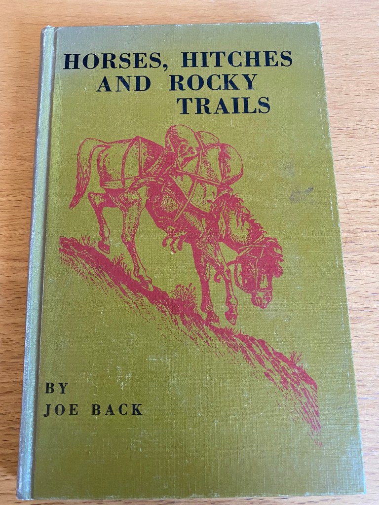
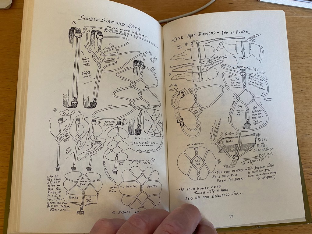

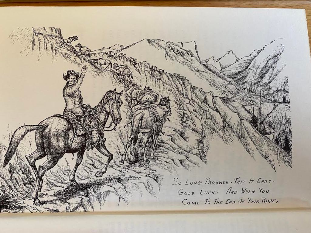

From Horses, Hitches and Rocky Trails by Joe Back, Sage Books, 1959.
Maybe it was my subconscious that led me to pull this old favorite from the shelf this morning as I thought about hitting the trail with Cowboy on aching knees.
From Horses, Hitches and Rocky Trails by Joe Back, Sage Books, 1959.
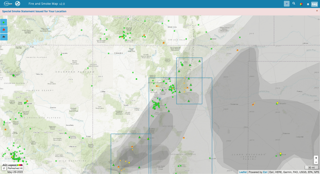


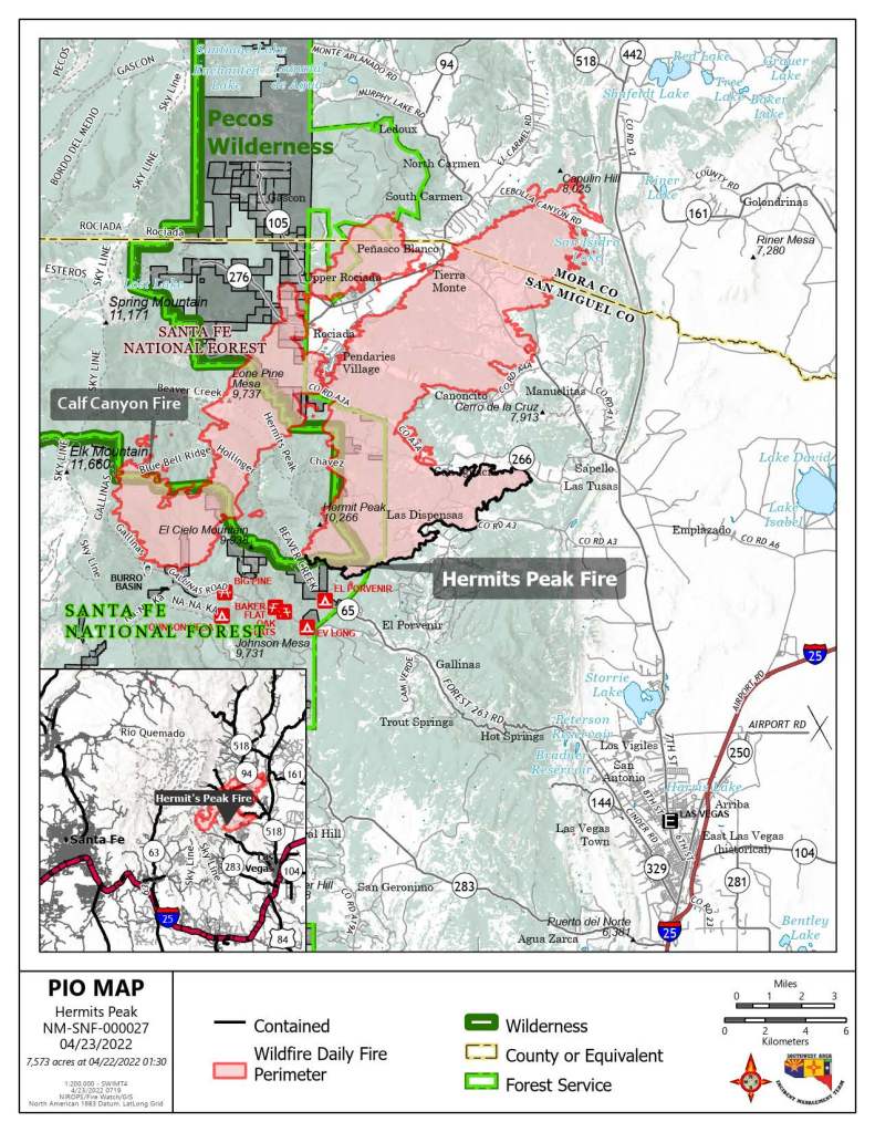
This is likely to change by tonight or overnight but it’s such a great (click here) interactive map I wanted to post it now.
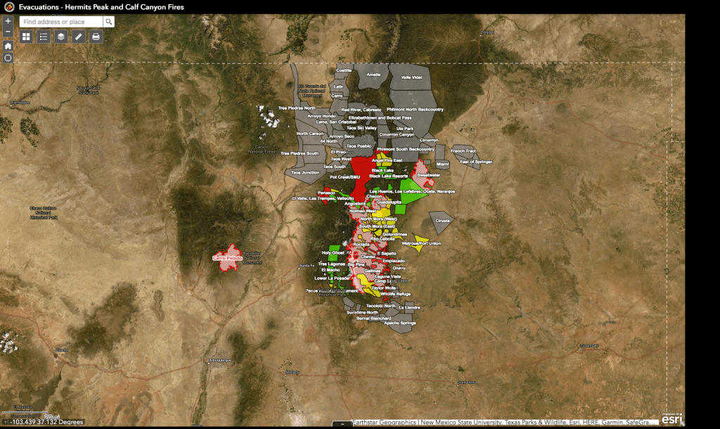
Here’s the link to the interactive map again. You can expand or shrink the detail. Plus it shows the two fires within my views, at least smoke plume-wise, in the same frame. https://nifc.maps.arcgis.com/apps/webappviewer/index.html?id=bfb95b09412840c0afd99626ea2bee4f
Evacuations spelled out in more details can be found on Facebook in news releases from the sheriffs of San Miguel, Mora and Taos counties. Daily fire briefings also are being streamed on Facebook.
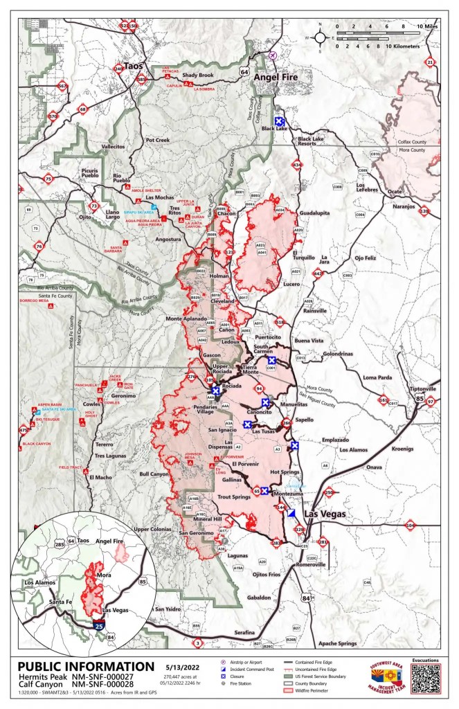
Key statistics for the Calf Canyon/Hermit’s Peak fire in the Sangre de Cristo Mountains this morning were: “Acres: 308,971| Containment: 40% | Total personnel: 2,707 Start Date: Hermits Peak: April 6, 2022; Calf Canyon: April 19, 2022 | Cause: Hermits Peak: Spot fires from prescribed burn; Calf Canyon: Under investigation.” Link to full morning briefing here.
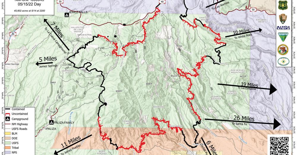
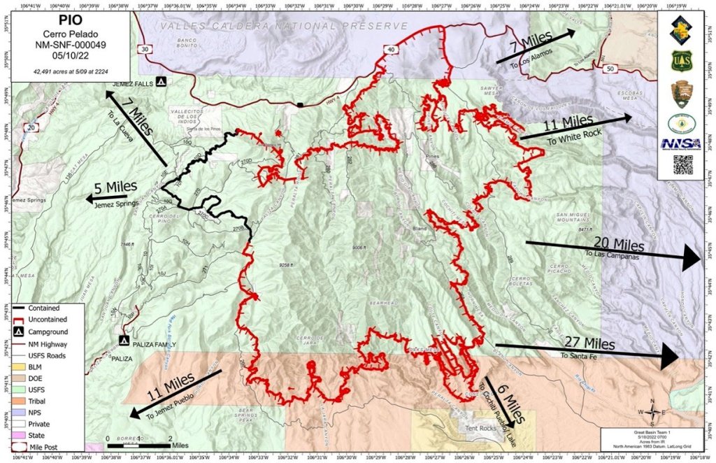
Key statistics this morning for the Cerro Pelado fire in the Jemez Mountains to the east were: “Current Size: 45,605 Acres Current Containment: 75% Start Date: April 22, 2022 Cause: Unknown Total personnel: 580.” Link to full morning briefing here.
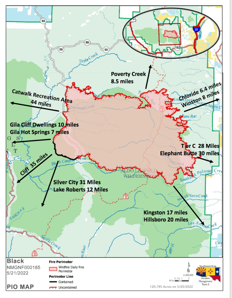
Meanwhile, I shouldn’t ignore the fast-growing Black Fire in the southwestern part of the state, already over 120,000 acres. Here is a link to an early 05/21 briefing: https://nmfireinfo.com/2022/05/21/black-fire-daily-update-may-21-2022/ And evacuations as of 3 p.m. Saturday: https://nmfireinfo.com/2022/05/21/evacuations-on-the-black-fire-expand-3-p-m-may-21-2022/
Can’t say my thoughts eased with the Forest Service nightly briefing Sunday on the Calf Canyon/Hermit’s Peak fire.
I hope we do not have to remember this as the fire that burned from Pecos to Taos.
The 40-day-old fire is near 300,000 acres and stretches 45 miles south to north through the Sangre de Cristo mountains, It might soon be declared the largest in the state’s history.
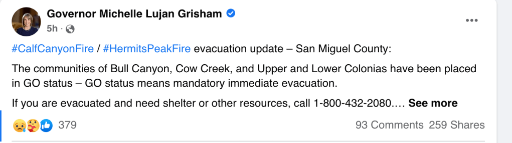
East winds expected tonight and I’m worried about pushes to the southwest toward the Pecos canyon and to the northwest into Taos County. Evacuations warnings for Upper and Lower Colonias and a couple of other areas near Pecos issued Sunday afternoon. Here is the full fire report for May 15:
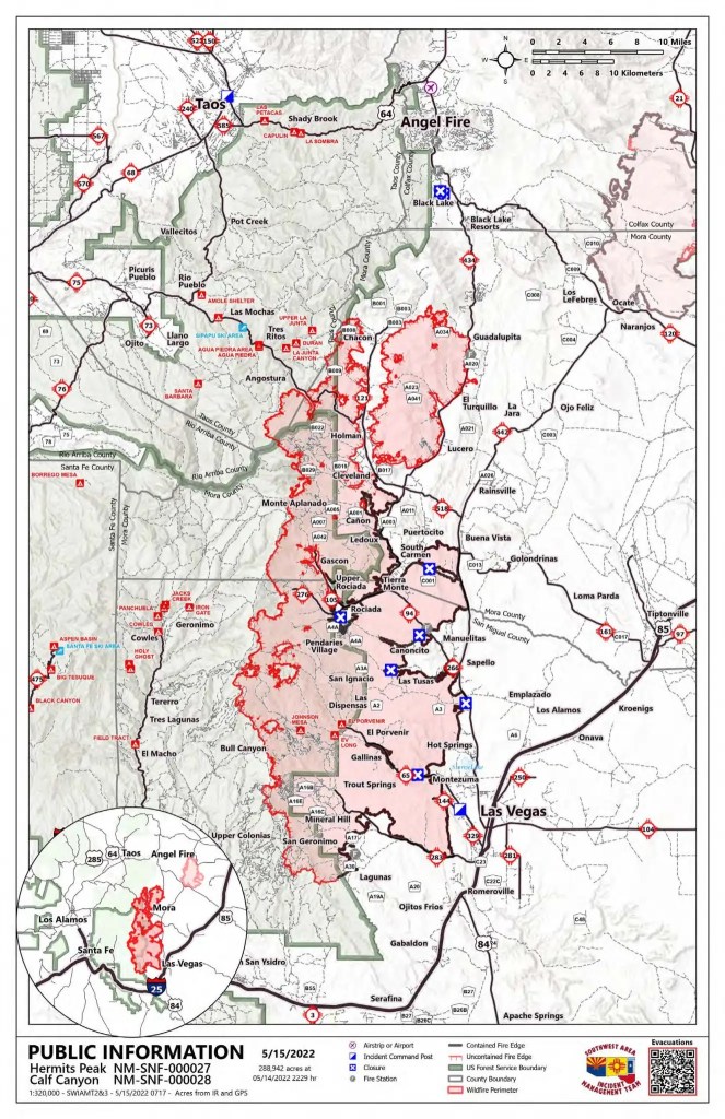
An army of nearly 2,000 people is fighting this beast but the country is steep and dry and full of little ranches and homesteads stemming from Hispanic settlement of the mountains in the 18th Century.
There is a 40 percent chance of thunderstorms over the mountains tomorrow but even they have firefighters worrying about outflow winds.
Things seem a little calmer on the smaller Cerro Pelado fire in the Jemez mountains, which started later than the Calf Canyon/Hermit’s Peak fire in the Sangre de Cristo. Here is the May 15 report:

Once upon a time, in high school days, I washed dishes in the white and gray-blue restaurant over the water in the forefront of this photo, the restaurant then the Glad Hand and now Scoma’s.
I lived with my mother and two brothers in an apartment in one of two rundown gingerbread Victorians almost directly across Bridgeway.
Thank you Al Engel and Bob Hanlon for employing me at the then red-painted Glad Hand and Wiley Bowens and Bobby Thompson for being my friends and helping me along.
Glad to say that I walked and rode my bike over that bridge and sailed under it in a couple of boats. My previous home had been at the end of Tano Road outside of Santa Fe, New Mexico, but this wasn’t a bad place to land in the midst of family upheaval.
Sausalito was a little more Bohemian in the early 1960s but my heroes then were Jack London and the older guys in short-sleeve shirts who magically parked cars on the wooden pier at the Kingston Trio-owned Trident, next door to the Glad Hand along with Ondine.
I also kept a sea bag packed in case some large sailing vessel came by, needing crew for a voyage across the Pacific. The Viveca, for one, was moored for a while off Ondine. Sterling Hayden’s Wanderer was down at the yacht harbor. Pursuit and Bolero and Baruna were sometimes there, too. Fortunately, Bob Hardin took me out on the bay and let me do occasional chores on his 40-foot schooner, Adventurous.
I used to feel sorry for myself washing dishes on Friday, Saturday and Sunday nights and seeing the world go by on Bridgeway. Now I feel lucky to have been there.
We were lucky to have them.

And big adventures begin, as noted in this item from the Granville Times in May 1948.

Best wishes this Mothers’ Day to all Bjelkes, Wheelers, Garretts, Robertsons and Harpers.
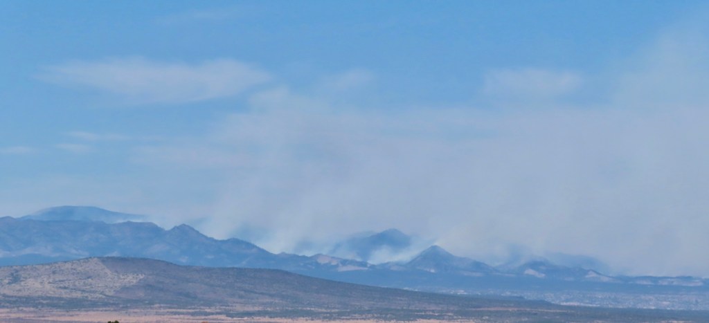
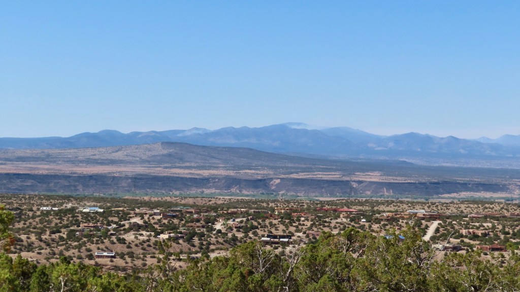
The Cerro Pelado fire in the Jemez Mountains, photographed from Placitas, spotting east on April 30. The fire started in what pundits called a big “wind event” on April 22 — Earth Day, by the way. It has burned into the 2011 Las Conchas burn scar but still threatens cabin clusters on several sides and “cultural resources,” namely sacred pueblo locations, to the south. Los Alamos is about 10 miles to the north. The treasured Valles Caldera, at the foot of Redondo Peak at the left of this frame, is closer, although still north of the fire this morning. The fire is just west of Bandelier National Monument this morning.
Cerro Pelado is throwing off a lot of smoke. Santa Fe, to the east, has been inundated for days but the smoke shifted to the south overnight and the upper Middle Rio Grande Valley is getting a lot of it today, 05/01/22.
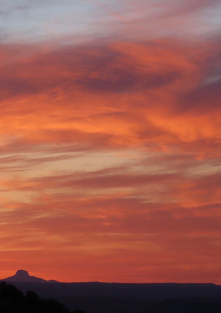
We’ve had good mornings here and there but today was not one of them.
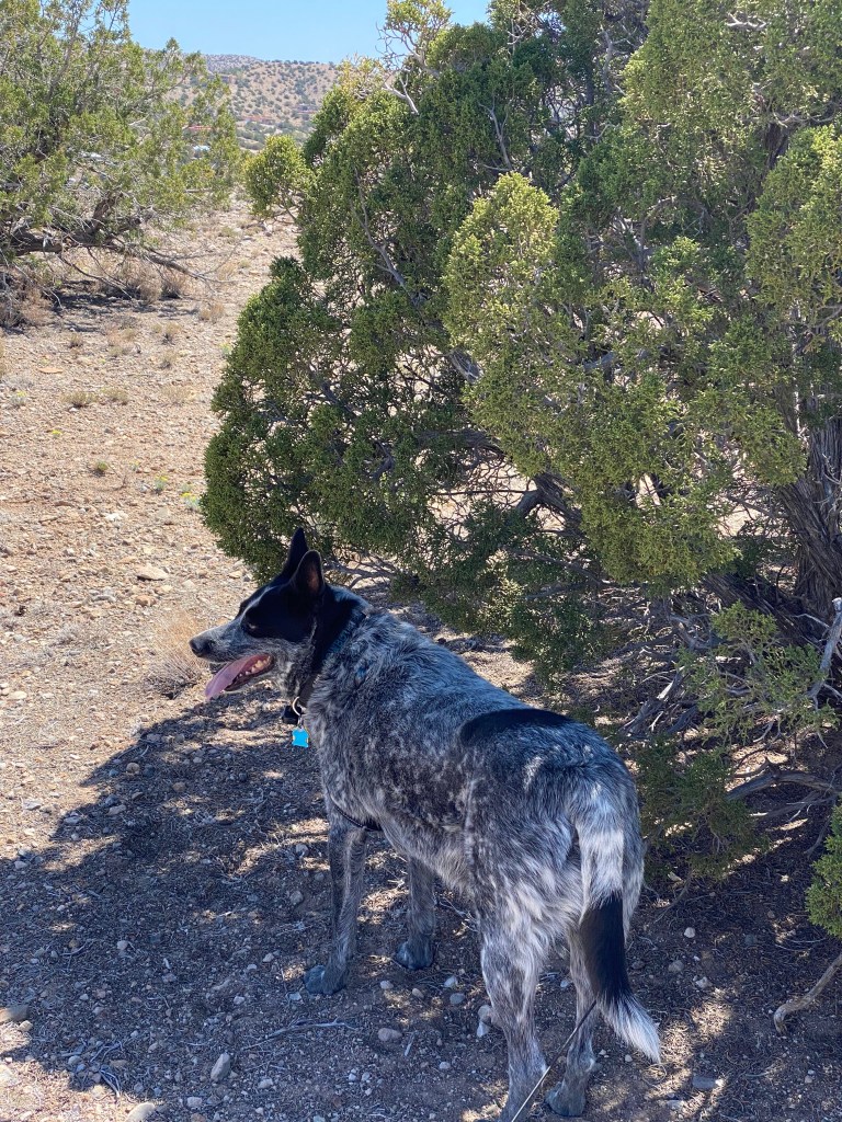
Cowboy was already starting to shade up on our walks, but this is more about climate warming and aridification than just a change of seasons.
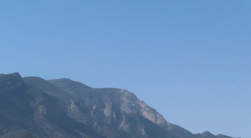

Snow on the north side of the Sandia mountain is almost entirely gone. If Placitas got any rain in April, I don’t remember.
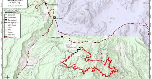
The Cerro Pelado fire was up to 15,650 acres on Sunday morning, 05/01/22.

The Hermit’s Peak/Calf Canyon fire on the east side of the Sangre de Cristo Mountains, near Las Vegas, is a bigger and even more threatening fire. (USFS photo).

The Hermit’s Peak fire, shown combined with the Calf Canyon fire this morning, 05/01/22, started April 6 when “multiple spot fires spread beyond” an earlier “prescribed fire project boundary,” according to official sources. The Calf Canyon fire to the southwest or the original fire, near Gallinas Canyon, was reported on April 19 and later combined with the Hermit’s Peak fire. The wind-plagued combined fire was near 100,000 acres on Sunday morning, 05/01/22.
Fire officials said Saturday night that, with no helpful weather in sight, it probably will burn for weeks and still could “easily double in size.” It has overrun and still threatens many small ranches and generations-old homesteads in the mountain valleys. It threatens the Las Vegas watershed and municipal water supply. It’s been clear from the comments of local sheriffs that some residents have wanted to stay home, despite evacuation orders, to protect their properties and livestock.
I’m not sure I’ve ever seen a fire sky as dark as the one photographed by Eddie Moore of the Albuquerque Journal from Las Vegas on 04/29.
Over a thousand firefighters were assigned to the fire as of 04/30/22. The San Miguel and Mora county sheriff departments were handling damage assessments and evacuation orders.
Oliver LaFarge wrote about the life of his wife and her family in the area in the 1920s, publishing Behind the Mountains in 1956.
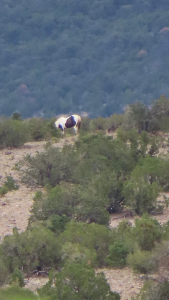
The black-and-white broadside of a paint horse on a hillside at least a half-mile away drew me out of bed this morning. The news from the Sangre de Cristos and Jemez was not good after Earth Day wind, fire and dust violence, but we seemed to luck out near the Sandia mountain.
The Calf Canyon fire on the Las Vegas side of the Sangres reportedly ran 15 miles overnight and was close to joining the Hermit’s Peak fire. The nearby Cooks Peak fire had doubled in size the night before. Growth of the Cerro Pelado fire in the Jemez, starting Friday afternoon, might be corralled by the scars of earlier fires.
None of those fires was labeled human-caused, though the Hermit’s Peak fire, starting April 6, is a runaway prescribed burn. Or as the Forest Service reported: “Cause: Multiple spot fires spread beyond the prescribed fire project boundary.”
At least 10 fires were reported around New Mexico on Friday. Gov. Michelle Lujan Grisham on Saturday said 20 were burning in 16 of the state’s 33 counties.
.Aridification — warmer and drier — along with wind gusting over 70 mph seemed the big factors here on Earth Day. Maybe not this time but downed power lines are a familiar culprit, too. There was no lightning this time around. Laura Paskus had a well-timed full-hour “Our Land” program Friday night on wildfire and climate change on NMPBS/New Mexico in Focus https://www.youtube.com/watch?v=-I45rcwfk0Q. I watched as the sun went down and the wind eased a little.
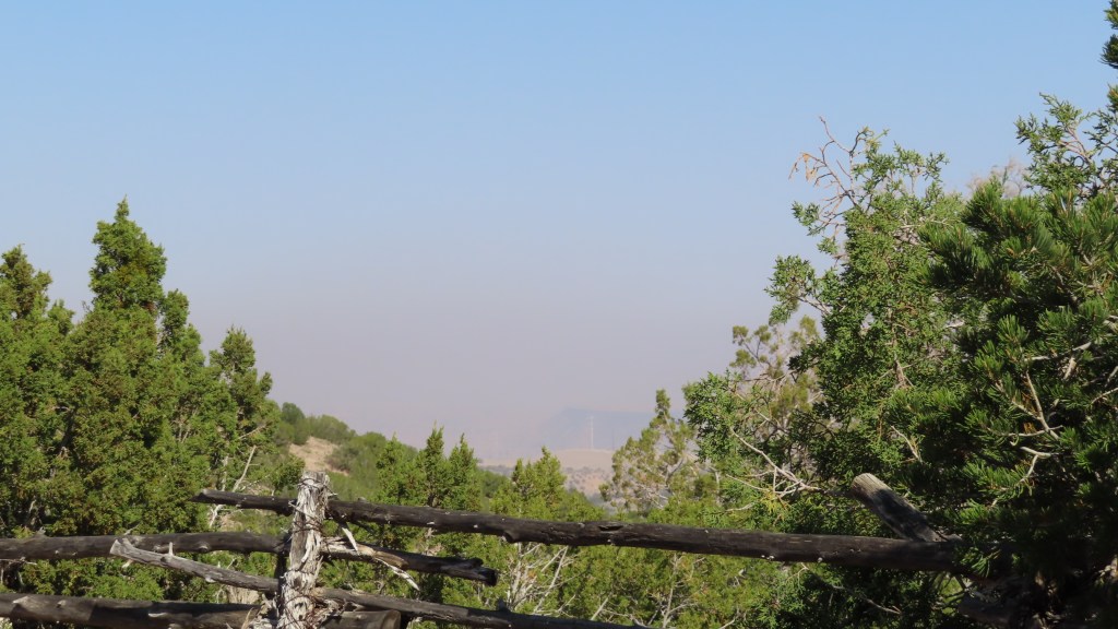
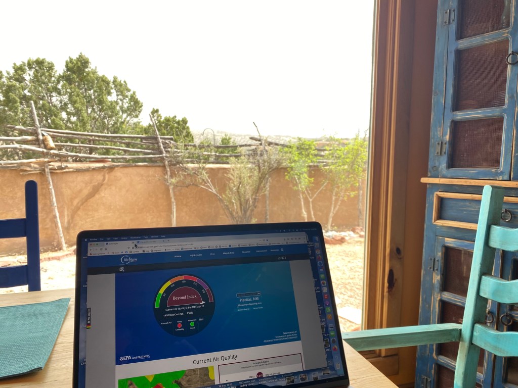
Wind-driven dust presented its own challenges on Friday. Twitter was full of images of obscured roadways, from Chinle to Albuquerque. Interstate 25 was closed for a while because of accidents near Algodones. I could not see the Jemez or the Sangre de Cristos from Placitas and only a faint outline of Sandia mountain showed just to the south of me.
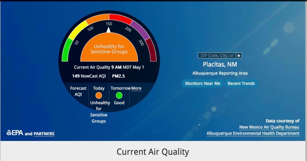
I saw something on my computer that I had not see before. With dust and smoke together, the air quality reading on the AirNow site had gone beyond readings of unhealthy very unhealthy and hazardous. On Earth Day it said, “Beyond Index”
I read a moment ago (11:30 a.m., 04/23/22) that the Calf Canyon and Hermit’s Peak fire have, in fact, joined. Structures apparently burned. https://nmfireinfo.com/2022/04/23/calf-canyon-and-hermits-peak-fires-combine/
Now for another windy day in New Mexico, Earth.
You can follow fire developments on the Facebook page of Santa Fe National Forest at https://www.facebook.com/santafeNF
