This is likely to change by tonight or overnight but it’s such a great (click here) interactive map I wanted to post it now.
Here’s the link to the interactive map again. You can expand or shrink the detail. Plus it shows the two fires within my views, at least smoke plume-wise, in the same frame. https://nifc.maps.arcgis.com/apps/webappviewer/index.html?id=bfb95b09412840c0afd99626ea2bee4f
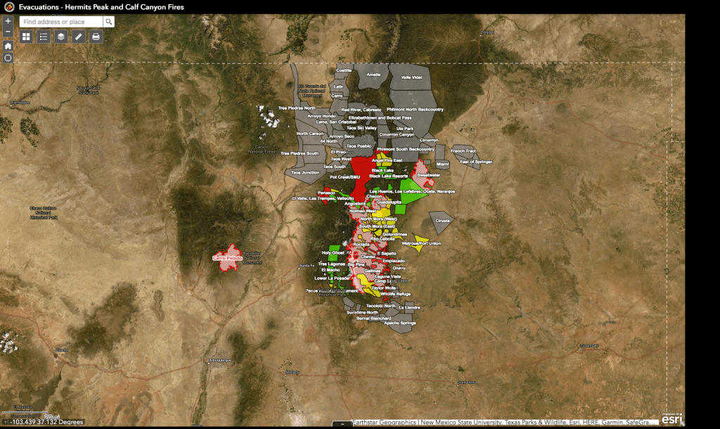
Evacuations spelled out in more details can be found on Facebook in news releases from the sheriffs of San Miguel, Mora and Taos counties. Daily fire briefings also are being streamed on Facebook.
Key statistics for the Calf Canyon/Hermit’s Peak fire in the Sangre de Cristo Mountains this morning were: “Acres: 308,971| Containment: 40% | Total personnel: 2,707 Start Date: Hermits Peak: April 6, 2022; Calf Canyon: April 19, 2022 | Cause: Hermits Peak: Spot fires from prescribed burn; Calf Canyon: Under investigation.” Link to full morning briefing here.
Key statistics this morning for the Cerro Pelado fire in the Jemez Mountains to the east were: “Current Size: 45,605 Acres Current Containment: 75% Start Date: April 22, 2022 Cause: Unknown Total personnel: 580.” Link to full morning briefing here.
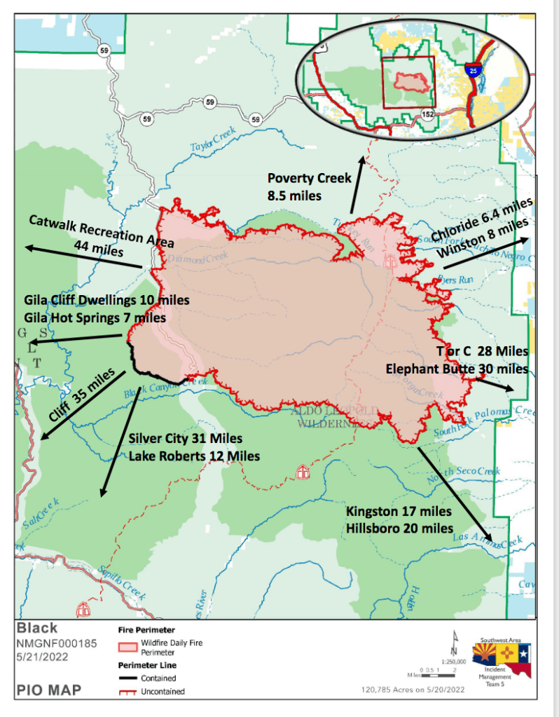
Meanwhile, I shouldn’t ignore the fast-growing Black Fire in the southwestern part of the state, already over 120,000 acres. Here is a link to an early 05/21 briefing: https://nmfireinfo.com/2022/05/21/black-fire-daily-update-may-21-2022/ And evacuations as of 3 p.m. Saturday: https://nmfireinfo.com/2022/05/21/evacuations-on-the-black-fire-expand-3-p-m-may-21-2022/