John Fleck comes up with the greatest maps and fortunately puts them on his website at http://www.inkstain.net/fleck/.
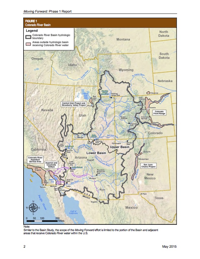
Fleck, who’s writing a book on water at the University of New Mexico, excitedly notes that this new Bureau of Reclamation map defining Colorado River Basin hydrologic boundaries shows them extending into Mexico. You can find more about this on his website.
The other thing that caught my eye, though, was the reminder of the phenomenal water engineering of the Colorado River, specifically the hatched areas on the map, outside of the basin boundaries, that receive Colorado River water despite distance and topography. These include parts of southern California and good old New Mexico, clear on the other side of the Continental Divide.
Fleck’s posting of the BOR Colorado River Basin map sent me back to one he’d written about for our former employer, the Albuquerque Journal: John Wesley Powell’s rendering of what he thought Western watersheds should look like.
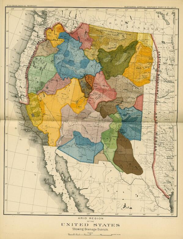
Watershed West: John Wesley Powell
At first glance, Powell’s map seems to make more sense. But maybe not if you want a tomato in December in New York or to escape New York’s snows for 18 holes in Phoenix. Or for that matter, water in your tap in Albuquerque or Santa Fe.
